This article is part of a blog series on drones, exploring what they are, and what they can do for the construction industry.
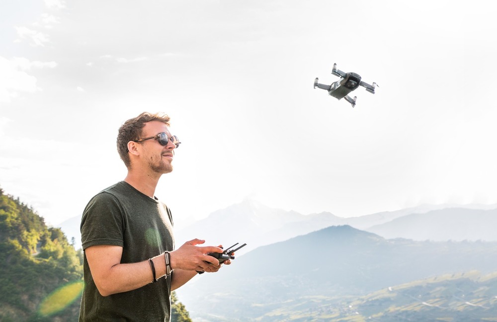
Drones, known as Unmanned Aerial Vehicles (UAVs), are becoming more popular. They are unbelievably valuable on construction sites and built asset maintenance.
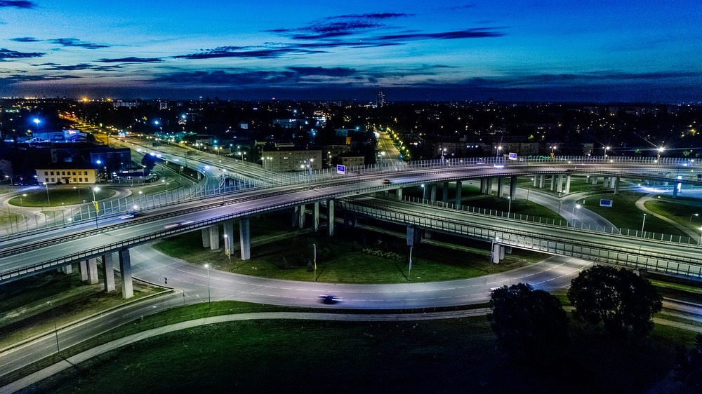
Drones are used to survey lands and existing buildings, keep track of machine inventory, improve safety, and streamline workflows.
Drones cut costs and labor, save time, mitigate risks, streamline processes, increase quality and accuracy, and increase collaboration efficiently.
BIM captures and analyzes cost-effective data collected by drones streamlining operational efficiencies so your profit margins increase. Capturing detailed aerial imagery helps evaluate the terrain, identify potential obstacles, and plan logistics more effectively to ensure accurate estimates and prevent costly reworks.
The data coming from drones is more accurate and efficient in surveying, and discerning potential hazards on a work site before they cause problems.
Your worker's safety improves driving innovation across the industry and offering new ways for the future of mapping in the construction space.

The global construction drone market was valued at $3.9 billion in 2023 and projected to reach $8.2 billion by 2032.
Drones are adequate and perform tasks efficiently and quickly, reducing the need for human intervention. Remotely seeing an aerial view of a construction site can help to know where things are located on-site and where they are needed.
Locating people and machinery reduces the probability of accidents and thefts and improves safety and security.
Drones can inspect the progress you have made in your project by mapping the construction site, even in hazardous areas.
The growth of the demand for drones is driven by the global need to build new houses. This requires large land surveys with difficult access on uneven terrain or containing rocky obstacles.
Initiatives like the Survey of India (SoI) are expected to drive growth in the construction drone market.
Drones and other technologies like GPS and artificial intelligence, make mapping activities easier and more efficient.
For example, using drone technology helped SoI to:
Governments in various countries have been under pressure to invest in residential and infrastructure construction to develop their economy and improve the standard of living.
For example, Japan invested $367 billion in infrastructure projects in Southeast Asian countries such as Indonesia, Singapore, Thailand, and the Philippines.
These initiatives help the construction industry worldwide to grow, expanding the need of drones and contributing to the growth of the construction drone market during the forecast period.
In the U.S., Canada, the UK, Europe, Russia, India, China, and Brazil, urbanization expanded due to high population growth posing major implications for the built environment and demand for housing in the short and long term.
An unexpected potential negative impact on the market is the war in Ukraine. Never in the history of warfare have drones been used as intensively as in Ukraine. Russians and Ukrainians depend heavily on unmanned aerial vehicles to pinpoint enemy positions and guide their hellish artillery strikes. The drone fleets of both sides are depleted, and they are racing to build or buy drones.
This market segment is projected to grow significantly, but it could be slowed down as drone margins are under pressure due to expensive specialized equipment like cameras, batteries, remote controls, propellers, and GPS antenna.
Another negative impact on the global market growth is the lack of a skilled workforce for designing, developing, and operating drones.
The drone offering is continuously improving to fulfill the needs of our industry.
For example:
The US-based TraceAir company provides an integration platform that combines topographic information, site measurements, and other data, collected by drones into any handheld device. As a result, civil engineers and construction supervisors have optimal visibility of the construction project progress in real time.
The Israeli company Civ Robotics flagship CivDot systems enhance productivity and precision for construction professionals, offering a significant improvement over traditional survey methods
In the UK, the company British Sees.ai offers remote drone operation solutions to construction companies. The control room simulates a virtual reality (VR) environment on-site enabling pilots to navigate the drones remotely. These increase efficiency, on-site worker safety, and profitability.
Advanced technologies are coupled with drones to improve the surveying of lands. They are:
For example, drones can create 3D models of large areas using laser scanners combined with standard topographic survey programs to identify what earthwork volumes are present on the construction site.
The global construction drone market is segmented into:
Types: fixed-wing drones and rotary-wing drones.
Application: surveying lands, infrastructure inspection, security & surveillance.
Clients: end users, residential, commercial, and industrial.
Regions: North America, Europe, Asia-Pacific, and LAMEA.
Acquisition, partnership, and product launch are major players. They adopt key strategies to remain competitive in the market.
Data produced by drones are used throughout the construction lifecycle, from feasibility to maintenance.
A topographic survey of the site with drones allows you to understand the environment of the future project, even during the strategy phase, and shows possible drainage points, changes in elevation, and locations for building, digging, or storing materials.
You can use the topographic survey imagery in the BIM Execution Plan to collaborate with architects, local authorities, and engineers.
With a drone, 3D models, and augmented reality you can:
Display an as-built building on the site to get a clear picture of how a digital building looks next to an existing one.
Assess how the new project will impact the area, practically and aesthetically, allowing analysis and visualization of cast shadows and views.
Import data such as curbs or manhole measurements into your CAD or GIS software to enrich existing data.
Maintenance may cost you a lot of money and time if you are using traditional facility management tools.
To prevent serious problems, you must ensure the quality and maintenance of your assets at reasonable costs.
Knowing where the assets are located and sending drones to verify where they are located visually makes the process much easier, even in hard-to-reach and hazardous areas. It is cost-effective and brings you accurate data in real-time.
The construction phase is where the drones will bring the highest value.
It's possible to generate a point cloud containing geospatial and color information, get precise volume measurements, and run a cut/fill analysis. With this information, you can accurately measure the amount of earth moved and save money as you know exactly how much to pay the contractors.
Accurate site visualization allows you to compare what was built overlaying the design to identify differences between planned and real-time progress, and correct errors incredibly early on to avoid costly reworks.
Using drones to survey progress allows you to check and validate the completed work on-site, every day. Keeping on top of the project progress shortens the construction process and ensures deadlines are met.
Monitoring progress with drones regularly, allows all stakeholders in their respective locations to know how things are progressing. It is more efficient and less costly than traditional site visits or helicopter images being out of date the minute they are taken.
You can update the operations schedules as needed, explain how the work should be performed, identify safe or hazardous areas, and send visual client reports about timing and budget.
When your project moves forward and reaches a milestone, you want to be sure that everything has been achieved to the highest quality standard. Further construction is based on that milestone, so if something has been done wrong, you will eventually get stuck and you may have to tear down what has been done previously.
Having up-to-date visual data can help you catch a mistake before it takes shape and avoid demolition and the related waste of time and materials.
If a mistake happens, and is built over, you will have regular documentation of the process, to check back to see where the mistake occurred more precisely and settle disputes without lengthy discussion, or even court cases.
Detailed documentation presents advantages to the contractors and the site owner, who will take over responsibility for the project once completed. Specifically, the owner can look carefully through the documentation before agreeing to the handover, and contractors can prove that the work has been conducted as per requirements, including details on who did what.
The drone market is expanding at high speed and is here to stay.
Drones can be used in all phases of a construction project. You can use construction drones remotely either for manual operation or automated operations to get an aerial view of a construction site to:
Drones could direct and guide autonomous vehicles to:
Drones enable site traffic to continue as normal without temporarily shutting down operations. This allows the surveyor's access to provide large amounts of reliable data including map-quality images, digital surface models (DSMs), and detailed point clouds so architects and site managers can improve the 3D modeling process.
Driving Vision can help you decide if investing in technology is right for you. Our technology diagnostic looks at the best way to incorporate innovative technology into your workflows.
A Driving Vision expert will conduct the interviews online and discuss the report and our findings with you. Together we will decide the best way to implement the solutions at your pace and according to your budget.
Implementing BIM can be daunting, but Driving Vision is here to help you at the pace you are comfortable with. Get started by getting in touch now
Seamless Data Transfer
Enhances collaboration between team members
Allows you to build green constructible assets on budget and on time